Marine habitat characterization is a critical step in assessing resources at risk, identifying ecological services, and developing suitable mitigation measures for the offshore industries. In deep water, remotely operated vehicles (ROVs) equipped with high-resolution digital cameras and lighting are often used to accomplish the collection of imagery that is used to examine and interpret seafloor features, including the identification of sensitive benthic habitats (e.g., hard grounds, seeps, deep-sea corals, and more). Water column habitats are also characterized by a combination of physical sampling and remote sensing methods.
Typically, comprehensive habitat characterization in deep water is accomplished using a tiered approach involving the collection and interpretation of acoustic and geophysical data followed by the collection and analysis of visual data, both using remote sensing tools to compliment physical samples. Here I focus on benthic resources and how communication technology is changing how ocean scientists structure their tiered sampling campaigns.
Remote Survey Capabilities
A recent post-drilling subsea inspection campaign conducted by CSA demonstrates the evolution of the tiered approach. This campaign involved reconnaissance and visual documentation of acoustically-identified seafloor features to determine the presence or absence of sensitive benthic communities in compliance with Federally-outlined industry best practices for protecting these deep-water benthic communities. The key to this recent project was that CSA scientists provided expertise and image interpretation remotely, without being deployed offshore to work on a vessel.
In this instance, the real-time remote benthic habitat assessment used a Starlink broadband satellite internet system to convey imagery collected by ROV teams working offshore to CSA benthic specialists working onshore. This added dimension to the tiered approach allowed real-time collaboration of science specialists with the offshore operations teams to accomplish survey objectives without the cost or risks associated with physically joining the vessel.
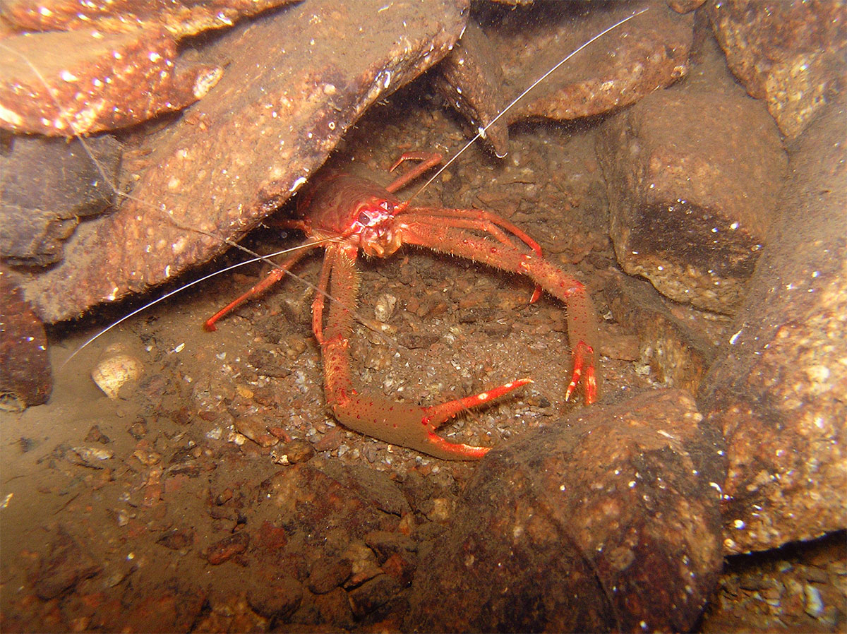
A marine decapod crustacean commonly known as a squat lobster.
In another recent project to assess decommissioning options for aged offshore platforms in the Gulf of Mexico, CSA scientists joined a decommissioning team offshore to examine ROV imagery carefully collected in the vicinity of platform structures. The objective of the project was to guide the collection of imagery and samples and to identify and characterize the epibenthic assemblages on the platforms and associated subsea infrastructure.
In both cases, real-time assessments by CSA scientists enabled the offshore industry client to characterize benthic habitats not only in compliance with regulations, but also to identify and avoid sensitive habitats.
The quality of these visual data is critical to compliment the analysis and interpretation biological and physical samples. The integration of the benthic specialist’s familiarity with the biota is important to enable recognition of biota and geologic features found on the seafloor in the deep ocean to help define mitigation strategies.
To ensure quality data collection using ROVs in deep water environments, CSA has developed a standard operating procedure for videographic data and image collection using ROVs, emphasizing the use of high-definition cameras and piloting the ROV over the seafloor with robust survey designs and in a particular manner to meet the data and image quality requirements of the analysis. High-quality visual data facilitates categorization of observed benthic habitats using various density-based classification schemes, including the Southeastern United States Deep Sea Corals (SEADESC) system and other methods. Standardization of collection methods will also aid not only in understanding the benthic resources present but also their effective management.
Deep-Sea Sampling
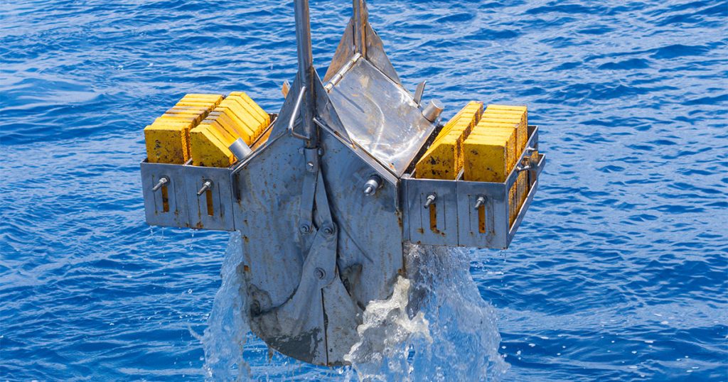
Outside of remote survey operations expertise, CSA is also uniquely equipped to perform deep water (4,000 m) sampling for biodiversity surveying. In 2022, CSA completed a deep-sea biota sampling campaign. Sampling at depth for biological samples, ocean conditions (turbidity, temperature, conductivity), and biogeochemical conditions (nutrient, oxygen, and trace metal concentrations) provided industry experts the required data to assess the health and presence of biological communities that could be impacted by offshore industry operations. Field operations experts employed a MOCNESS (Multiple Opening/Closing Net and Environmental Sensing System) and a CTD rosette sampling to obtain data.
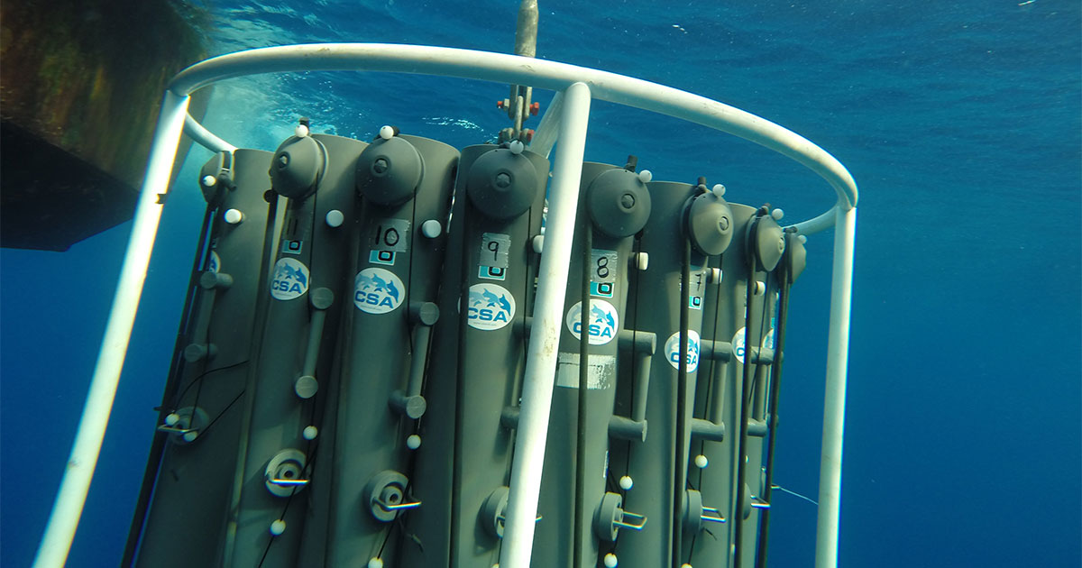
Deep-sea water sampling campaigns improve managers’ knowledge of benthic and water column chemistry. (Image credit: CSA)
CSA Ocean Sciences Inc. (CSA) has been providing benthic habitat characterization services to the offshore industry since the 1980s when US regulations sought to limit potential impacts to marine habitats on the continental shelf. These early large-scale habitat characterization programs were instrumental in developing CSA benthic specialist expertise specific to taxonomy, natural history aspects of marine habitats, and broad familiarity with substrate and biological associations. CSA’s provision of these services continues with various programs and methods to address concerns for assessing risk and devising mitigation for offshore resource development.
This feature appeared in Environment, Coastal, and Offshore (ECO) Magazine’s 2023 Deep Dive III: Deep-Sea Exploration special edition, to read more access the magazine here.