“This new technology brings a new dynamic to our surveying capabilities, allowing us to rapidly acquire multifaceted aerial data sets covering large coastal and offshore areas,” commented Dave Coggin, Vice President of M&E. “Our teams can combine these data with those collected from our other topographic and hydrographic methods, giving our clients the most complete picture possible to accurately assess nearshore erosion monitoring, construction, and/or biological monitoring needs.”
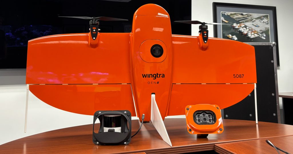
The WingtraOne Gen II is a fixed-wing, vertical takeoff and landing UAV that can accommodate three types of payloads. It features an RGB 61-megapixel camera and PPK GPS for photogrammetry, enabling the generation of aerial photography and point clouds. The Hesai XT32 LiDAR sensor produces LiDAR point clouds, which are suitable for providing ground points in vegetated areas. Lastly, the Micasense Red edge-P six-band multi-spectral camera is ideal for biological resource surveys.
“The incorporation of an advanced UAV like the WingtraOne Gen II into our expanding portfolio of next-gen marine survey technologies allows our group of companies to provide best-in-class survey solutions from on, below, and now above the waterline,” added CSA President Gordon Stevens. “UAVs outfitted with specialized high-resolution cameras not only offer new perspectives on marine life and critical ocean processes, but they offer near-real-time observational insights from the skies, allowing field teams to make informed and timely decisions needed to guarantee mission success and efficiency.”