On this World Hydrography Day, we celebrate the vital role that hydrography plays in creating a safer and more sustainable future for our oceans. The International Hydrographic Organization (IHO) traces its origins to the First International Hydrographic Conference held in London in 1919, where representatives from 24 nations met to improve cooperation, standardize hydrographic practices, enhance nautical charting, and facilitate the exchange of hydrographic information. This effort led to the establishment of the International Hydrographic Bureau (IHB) on June 21, 1921, which later became the IHO in 1970.
The IHO develops key international standards, including S-44, the Standards for Hydrographic Surveys, which define requirements for the accuracy and quality of hydrographic data. These standards support the effective use of modern technologies such as multibeam echo sounders (MBES), uncrewed surface vessels (USVs), autonomous underwater vehicles (AUVs), and satellite-derived bathymetry.
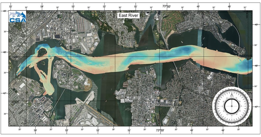
Today, CSA Ocean Sciences (CSA), part of the APEM Group along with our wholly owned subsidiary Morgan & Eklund, uses advanced technology to push boundaries, innovate, and provide valuable data-led insights that support the safe and sustainable exploration of marine environments. In our world, the realm of hydrography goes beyond the science of measuring, describing, and mapping the physical features of water bodies. It is a multifaceted survey discipline that sits at the intersection of science and practical safety.
Every vessel that navigates safely into a port, through a strait, or across an ocean shelf does so relying on hydrographic data, whether that information was collected and processed recently or several years ago. As vessel sizes increase and offshore industries expand into deeper, remote waters or hard to navigate coastal shallows, the accuracy of those data becomes increasingly critical.
The reality is that modern hydrography is constantly being sharpened by technological upgrades. Multibeam sonar systems—like the Kongsberg EM 304 MKII recently installed on E/V Nautilus—can map wide swaths of seabed simultaneously at high resolution, replacing the slow, single-beam sounding methods of the past. USVs are also now being deployed to conduct hydrographic surveys in shallow or hazardous areas where crewed vessels are unable to safely operate, while satellite-derived bathymetry is helping fill gaps in remote regions.
CSA has been designing and conducting hydrographic surveys for clients around the world since 1970. Regardless of the application or scope, we have the scientific subject matter expertise, marine operations professionals, and platforms and technologies to deliver best-in-class data collection, processing, and analysis.
Happy World Hydrography Day to all the survey professionals out there!