Versatile ASV Solutions for Offshore and Coastal Missions
CSA operates a growing fleet of autonomous surface vehicles (ASVs) to support a wide range of marine operations, from environmental surveys to scientific research and military deployments. These unmanned platforms enable efficient, low-impact data collection across diverse mission profiles and ocean conditions. Our ASVs are deployed for:
- Bathymetric and seafloor mapping
- Habitat classification and environmental monitoring
- Sediment and water quality sampling
- Metocean data acquisition
- Archaeological investigations and search-and-recovery
- Marine infrastructure inspection and hazard clearance
- Pre-disaster baseline capture and post-disaster response comparison
- Experimental research and survey stratification
- Reconnaissance in environments unsafe for humans
Whether for standalone missions or integrated with broader survey operations, CSA’s ASVs offer a cost-effective, low-emission, and flexible solution for modern marine data collection.
Configurable Technology for Complex Operations
CSA’s marine survey team has deep expertise in outfitting ASVs for multipurpose missions, ensuring optimal configuration of sensors, payloads, and deployment strategies. Our platforms are engineered to serve both operational and R&D roles—capable of supporting:
- Custom sensor integration
- Launch and recovery system testing
- Propulsion and software trials
- Communication technology validation
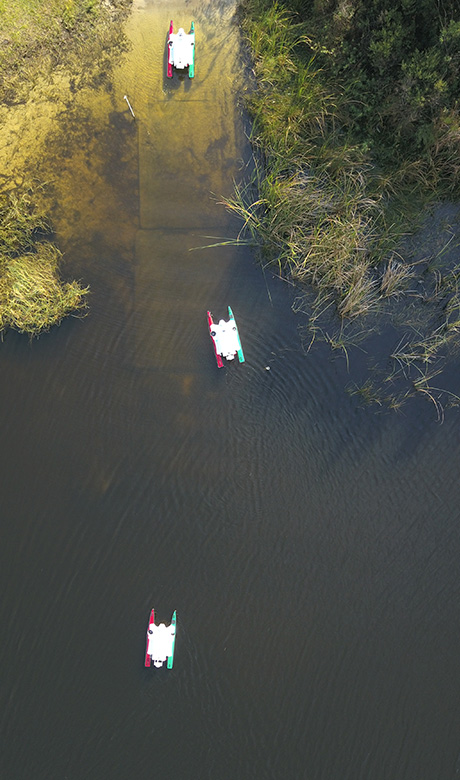
We leverage proprietary software to control ASVs, sensors, and payloads, ensuring precision and adaptability in real-world conditions. Working closely with leading survey software providers, CSA is continually enhancing platform capabilities to support multi-vehicle coordination, extended-range operations, and deployment in more remote or challenging environments.
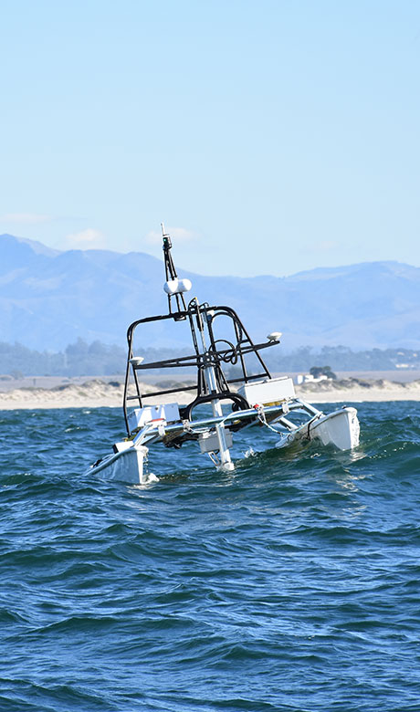
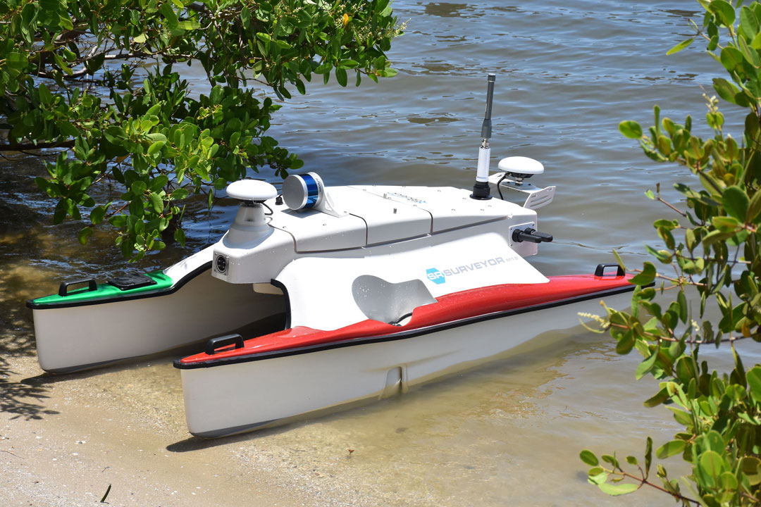
CSA ASV Fleet
Our growing ASV fleet includes vessels ranging from compact survey craft to larger offshore-capable models. This scalable fleet allows CSA to tailor operations to specific project scopes—from nearshore mapping to extended offshore environmental assessments.
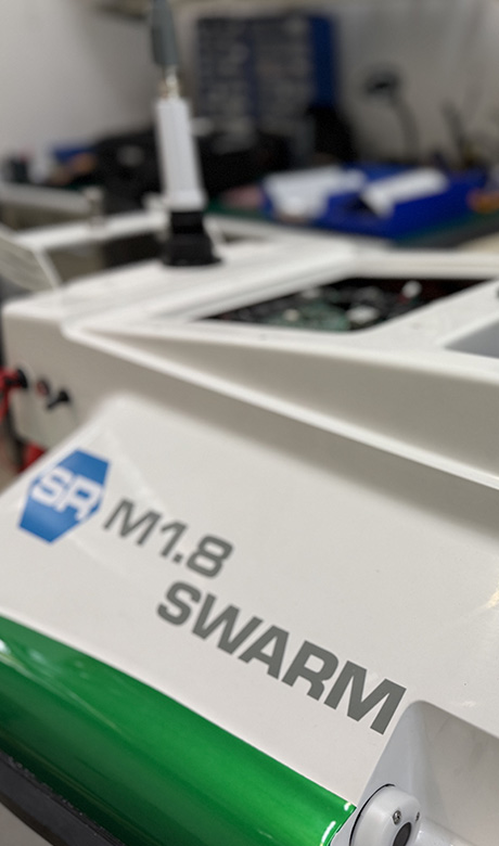
- 1.8 m Surveyor & Surveyor XL
- 4.0 m Class ASV
- 5.0 m Class ASV
- 11.0 m Class ASV
Environmentally Conscious Operations
CSA prioritizes sustainable operations with ASVs designed for minimal environmental impact. These features make CSA’s ASVs ideal for operations in sensitive marine ecosystems or areas with strict environmental compliance requirements.
- Most ASVs are battery-powered, producing zero emissions
- Diesel-powered units are equipped with acoustic noise mitigation and vibration isolation systems
- All cooling systems use closed-loop configurations to prevent seawater contamination
- Shaft seals and bilge systems are engineered to minimize or filter any potential discharge
Explore CSA’s ASV Capabilities
CSA’s vehicles deliver a robust, sustainable, and data-rich solution for modern marine challenges. Whether supporting government, industry, or research initiatives, our ASVs bring flexibility, reliability, and precision to the forefront of offshore science and operations.
These features make CSA’s ASVs ideal for operations in sensitive marine ecosystems or areas with strict environmental compliance requirements.
MARINE DOMAIN AWARENESS FROM ABOVE
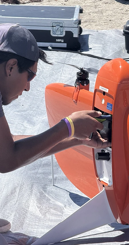
In recent years, CSA has taken marine survey to new heights with the integration of UAVs as part of the company’s ongoing investment in the latest remote mapping and monitoring technologies.
CSA owns and operates a WingtraOne GEN II as part of its fleet of unmanned assets. The WingtraOne GEN II is a fixed-wing, vertical takeoff and landing UAV with PPK GPS that can accommodate various imaging payloads, including an RGB 61-megapixel camera for photogrammetry, a Hesai XT32 for LiDAR point clouds, and a Micasense Red edge-P six-band multi-spectral camera ideal for biological resource surveys.
This high-caliber UAV allows field teams to rapidly acquire multifaceted aerial data sets covering extensive reaches of the coastal and offshore domain, making it instrumental to timely and cost-effective for hydrographic and geophysical surveys supporting coastal planning and infrastructure planning and monitoring.
Learn More About CSA Ocean Sciences