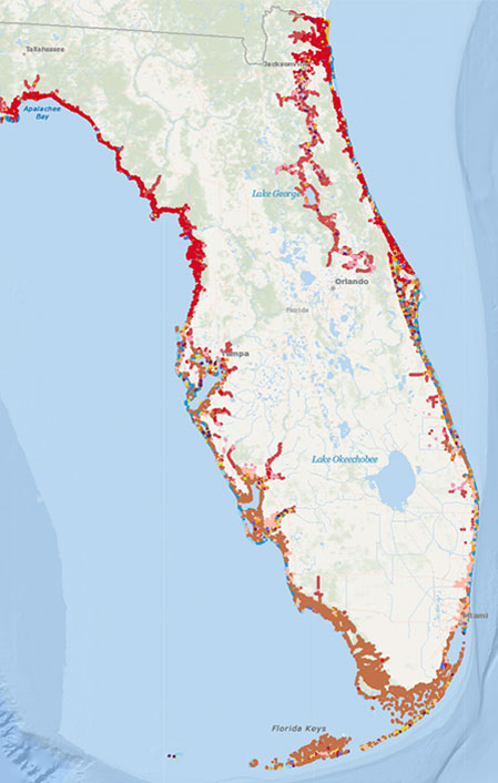
The Environmental Sensitivity Index (ESI) is a widely-used system for classifying shoreline types and socioeconomic features that may be impacted by oil reaching the shoreline.
ESI Shore Types are ranked from 1 (low sensitivity) to 10 (very high sensitivity) on the basis of the following:
- Shoreline type (including grain size and slope) and its influence on oil penetration, transport, and/or burial;
- Exposure to waves and tidal currents to understand the persistence and potential residence time of oil on the shoreline; and
- General productivity and sensitivity of habitat and biological communities.
Shoreline characterization using the ESI classification system also identifies other potentially sensitive features from a socioeconomic perspective, including human use, wildlife use, industry activities, and fishery resources using standard symbology.
To implement shoreline characterization on a regional scale, CSA has developed a technique to acquire, examine, and interpret high-resolution, georeferenced satellite imagery for the purpose of assigning ESI shore types and features using Geographic Information Systems (GIS) software.


